The mission of the Tregaron Conservancy is to preserve, rehabilitate and maintain the Tregaron Estate’s historic landscape for the benefit and enjoyment of the public. As the owner and steward (in perpetuity) of this historic woodland garden, the Conservancy is dedicated to renewing the landscape sustainably, to ensuring a healthy plant and wildlife habitat, and to educating and inspiring our visitors. To learn more about our treasured historic landscape, as well as the Conservancy’s projects and programs, watch this short volunteer-created video.

The Conservancy’s Key Goals
With 13 acres of land in Washington, DC placed into a conservancy as open green space, the Tregaron Conservancy has preserved, stabilized and begun to rehabilitate what was once a severely neglected and deteriorated landscape.
All of the Conservancy’s work is guided by the original landscape designs of architect Charles Adams Platt and landscape architect Ellen Biddle Shipman, and by consultation with preservation-focused landscape architects, arborists, horticulturists and other professionals.

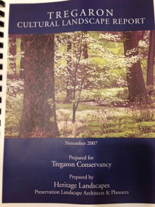
In 2005, Heritage Landscapes, an internationally recognized preservation landscape architecture and planning firm, prepared a detailed Cultural Landscape Report (CLR) for the Tregaron Estate. The completion of the CLR in 2007 was generously funded by the Dorothea de Schweinitz Preservation Fund of the National Trust for Historic Preservation.
The CLR provides a comprehensive study of this historically significant landscape. The Report consists of landscape-focused historical research, period plans and photos, documentation of existing conditions, and assessments of landscape integrity and character. It concludes with a series of preservation treatment recommendations that provide the basis for undertaking preservation, interpretation and management of the land.

The CLR analyzed the landscape and its existing conditions in great detail, area-by-area, and recommended the following:
- Conservation and repair of historic stone structures of walls, bridges and steps;
- Reconstruction of the Bridle Path and subsidiary footpaths;
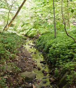
- Stabilization and repair of the pond edge, pond inlet and outlet, and stream course;
- Woodland renewal work of several types; and
- Attention around historic buildings to recapture elements of landscape character and conserve remaining historic features.
Following this guidance, the Conservancy was able to lead a carefully planned and directed campaign of phased actions to stabilize, repair and recapture features of landscape’s woodlands, gardens, meadows, paths and waterways, over its first decade.
In 2017, the Conservancy embarked on a new phase of planning, once again funded by a grant from the Dorothea de Schweinitz Preservation Fund of the National Trust for Historic Preservation. Working with landscape preservationist Glenn Stach, we sharpened our focused on preservation viewed through the lens of sustainability. This planning project culminated in a report entitled “Tregaron Landscape Preservation and Sustainability Study: A Wild Garden for the 21st Century. This ambitious report features detailed site analysis, management recommendations, area plans for each of the Conservancy’s “outdoor rooms,” and highlights of our ongoing preservation/sustainability-focused work. While we are continuing to make progress in interpreting and rehabilitating the landscape based on this study, many projects remain to be funded. To learn how you can support our project goals, contact Executive Director Lynn Parseghian at lynn@tregaronconservancy.org.
Read the Cultural Landscape Report
Note that each Part is a PDF; some files are quite large.
Part 1 – Cultural Landscape Report
Part 2 – Cultural Landscape Report
The Cultural Landscape Report’s List of Plans and Photo Sheets:
Part 1 — Platt-Shipman Sketch Plans
Part 2 — Platt-Shipman era vintage photographs with location notations
Part 3 — 1948 aerial photographs with landscape units
Part 4 — Davies Era vintage photographs
Part 5 — 1980 WIS-TLP aerial photographs, 2000 aerial photographs, 2005 aerial photographs
Part 6 — 2005 photographs with location notations
Part 7 — 2005 drawings of existing conditions and features, 2007 Project Areas Plan
Part 8 — Vegetation Management Plan, Illustrations
Part 9 — Illustrations


